INTRODUCTION
The concept of smart cities has become imposing itself on our daily life. Navigation and finding our way in a city we have never been before, wither we are riding, driving or even walking, is not a challenge anymore! Thanks for way-finding systems, digital maps and -of course- consistent internet connection. However, those smart systems or applications occasionally would mislead us through our trip, as they designed to collect robotic information and provide data on that base. On the other hand, in some cities you won’t find physical wayfinding systems, especially for pedestrians! An issue that we are living in our city Amman, in addition to all other cities in Jordan.

THE INITIATIVE
OVERHAUL management decided to use the capacity of Amman's studio and their design team to give to our community the “OnFoot Map” system, as a pedestrian spatial solution.
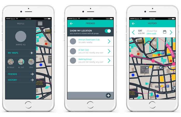
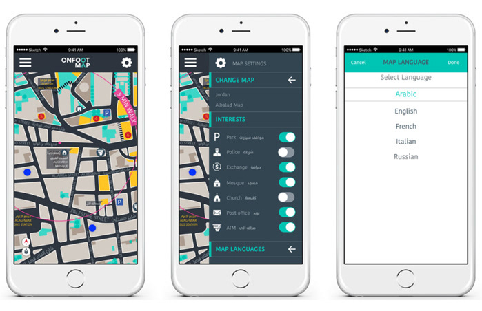
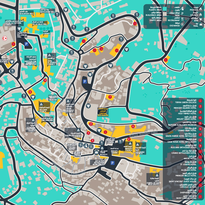
This solution, is maps based content for walking districts within our cities, designed from a pedestrian point of view, and presented through 4 different applications: Printed maps booklets. Website, where users can download or print the map they need. Mobile app. And a smart street totem, which contain location map and directions panel, it also provide a device power charger and WIFI spot, which all depends on solar power.
APPROACH
The whole system was designed not only to provide accurate and essential information, but also to be usable!. To achieve that goal, the solution should connect people to each other’s, provide internet and power for the users’ mobile devices, and to be affordable for our government to build it. Therefor it should be designed by local designers who are connected to the place and people.
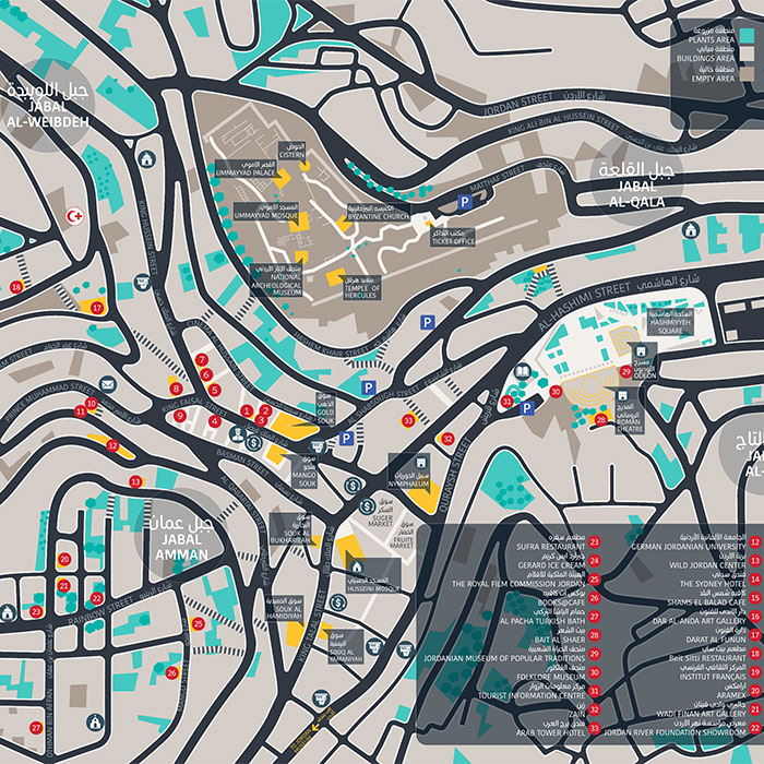
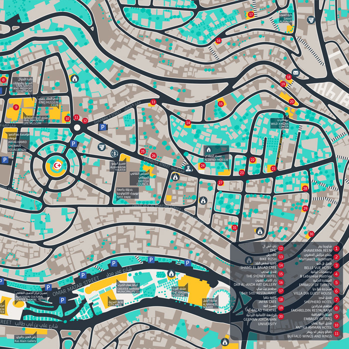
The maps was designed at first based on satellite images, before it was tested and audited in streets, so the team can provide specific data that the robots would not, and satellite cannot reveal! such as roofed alleys, local shortcuts or long stairs, which are many in Amman. In Addition, on those maps a local terms and destinations’ names should be applied. Finally, highlighting places and landmarks were set according to real user experience.


RESULTS
A piloting project has been designed and produced, includes:
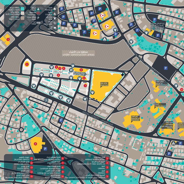
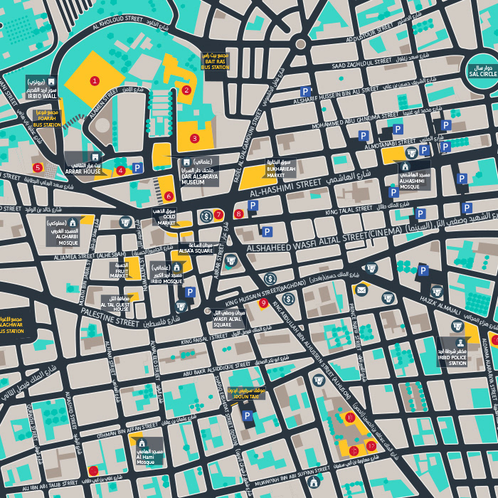
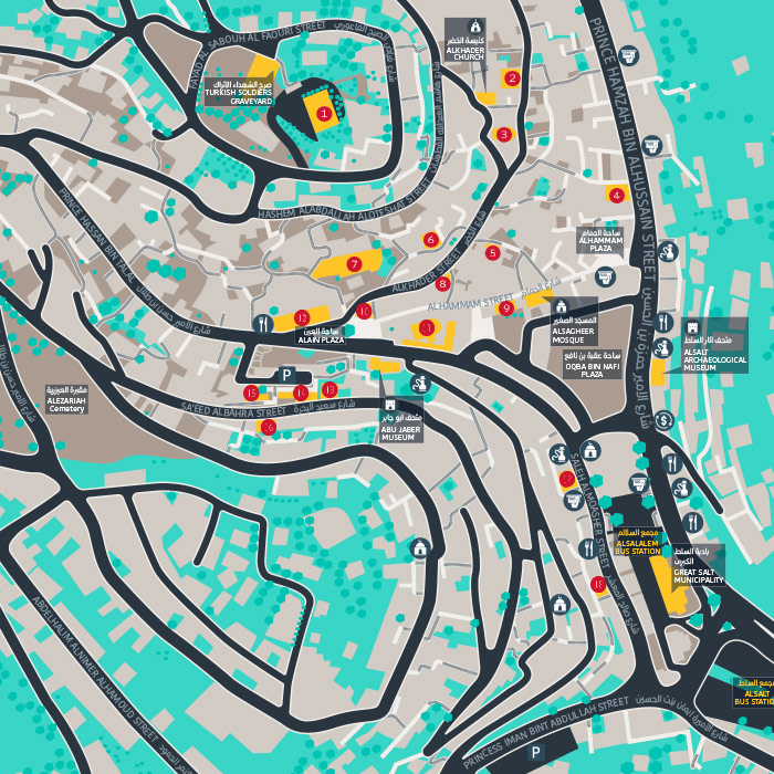
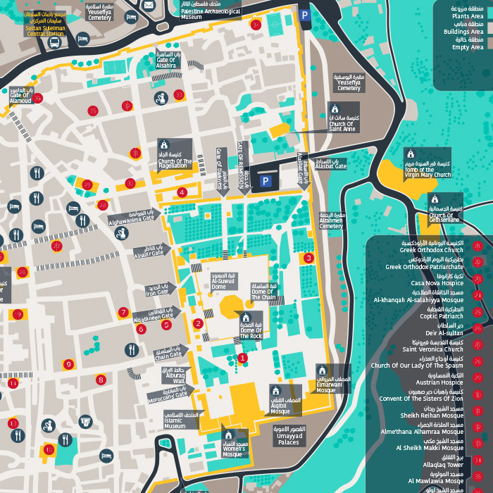
- Walking maps for 14 main pedestrian areas in center and west Amman, each area spread across 3 square km. In addition to maps for the city center of: Jerusalem, Irbid, Salt, Nablus, Bethlehem
- The pocket Maps booklets.
- Functioning mockup of the smart street totem.
- Website, present ready to download or print maps.
- Mobile app prototype.
The project has been presented to the city mayor and was very appreciated by the municipality board. Waiting for government activation!.